Historical Streamflow and Climate data
|
Historical Weather Information |
|
|
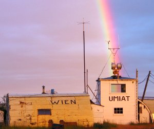
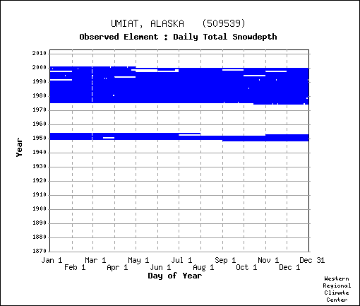
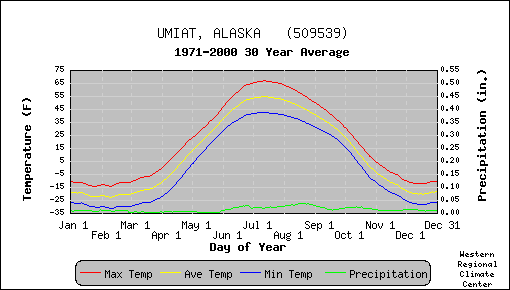
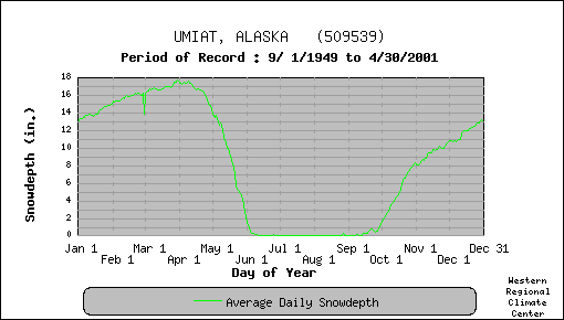
WRCC Umiat Airport period of record: temp - precip - snow
|
|
|
other weather and river info |
|
|
This will be updated this summer |
|
| Ikpikpuk gage weather 2003 2004 2005 2006 2007 summary | |
| Fish Ck gage weather 2003 2004 2005 2006 2007 summary | |
| Colville R weather 2003 2004 2005 2006 2007 summary | |
| 2003-07 Fish/Ikpikpuk/Colville Precip Report pdf doc summary | |
| 2003-08 Fish/Ikpikpuk/Colville/Meade Precip xls |
|
North Slope River Gauges and weather |
|
Rivers |
Stage- Discharge- Peakflow |
| Colville River at Umiat | |
| Ikpikpuk River bl Fry Creek | |
| Meade River at Atqasuk | sorry, see USGS |
| Ublutuoch R Mile 13.7 | |
| Fish Creek Mile 32 | |
| Judy Creek Mile 7 | |
| Otuk Creek at Ivotuk | soon |
| Seabee Creek | |
| Prince Creek | |
Missing your favorite link? Any additions are welcome! |